Cherokee: Tourists and Indians
Cherokee, North Carolina
Throw a rubber tomahawk in the town of Cherokee and it will probably bounce off a moccasin shop or a tourist taking a snapshot. It's been this way since the late 1940s, when Uncle Sam paved the mountain roads leading to this remote town, at the heart of an 83-square-mile chunk of land known as the Qualla Boundary, owned and governed by the Eastern Band of the Cherokee Nation.

Once the curious outsiders began to arrive, the justifiably bad feelings the Cherokee may have had about the Trail of Tears were assuaged by a flurry of free enterprise tourist engagement. An outdoor drama, "Unto These Hills," was created; a Colonial-Williamsburg-style Indian village was built; motels with neon signs gathered like Smoky Mountain bears at a wayside trash can. Cherokee's main street was dotted with friendly Indians in ceremonial costumes, ready to be photographed with anyone for a few bucks (An innovation later copied by today's urban tourist picture-posers). A surprising Santa's Land was built; so was a less-surprising snake farm, and pits for the bears. Gift shops jockeyed for position downtown, eager to offer white people the opportunity to buy t-shirts and fudge from a real Indian.

An influx of money in the late 1990s -- thanks to tax-free cigarette sales and the only casino in North Carolina -- gave Cherokee the cash to bankroll a fancy museum and a more upscale approach to the Eastern Band's heritage. Yet while time and changing tastes have winnowed some of Cherokee's vintage past, a surprising amount of it still remains, shielded from the upheavals that churn tourist towns on the Tennessee side of the Appalachians. Gatlinburg and Pigeon Forge bulldoze the past in a race to the 22nd century, but parts of Cherokee could still be 1955.
Cherokee's west side buttresses the Great Smoky Mountain National Park, so its commercial mojo spills eastward and downhill into the town of Maggie Valley. Here, too, the attractions have a reassuring retro feel, tapping classic tourism tropes and catering to shutterbugs. People don't drive to this part of North Carolina for personal growth or visions of the future. They come to see the Indians.
- Pose with Indians - and Bill the Buffalo
- Gold Indian Erupts From Turtle
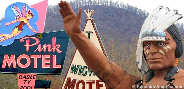
- Pink Motel
- Museum of the Cherokee Indian
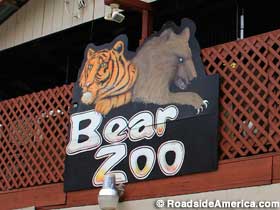
- Cherokee Bear Zoo
- Indian Death Tiki of Awesomeness
- The Cherokee Trader
- 25-Foot-Tall Indian Muffler Man
- Wigwam Motel
- Most Photographed View in the Smokies
- Mac's Indian Village Cabins
- Wheels Through Time
- Peter Toth Giant Indian Head
- Big Red Rocker
- Chief Henry Profile Sign
- Ghost Town in the Sky
- Santa's Land


