Fake farmhouse hid radar power generators.
Radar Station B-71: Farmhouse Disguise
Klamath, California
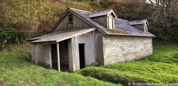
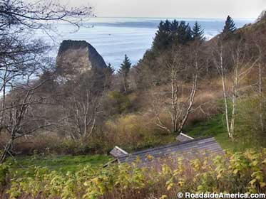
This idyllic discovery is along a narrow road in Redwood National Park. Against a craggy sea rock backdrop, an old farmhouse and barn sit cozily on the slope. But wait! Those buildings once camouflaged part of America's wartime radar defenses.

Coastal vantage point.
Following the Pearl Harbor attack in 1941, America's military worried about Japan's ability to invade or damage the West coast. As part of America's defense vigilance, early radar stations were installed along remote cliffs, disguised as quaint farmhouses if viewed from the sea or air. About 65 sites operated along the Pacific Ocean, and this is the last still standing.
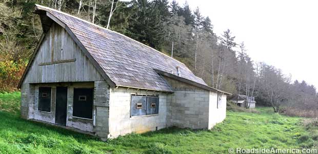
The Klamath River installation was Station B-71 (called "Trinidad" because it was next the historic Trinidad-Crescent City wagon road). Manned by the Army Air Corps, the site featured a cinderblock Operations Building contained within a barn facade, and a cinderblock generator building (to power radar equipment), in the guise of a farmhouse. The two-stall outhouse didn't require a disguise.
The radar installation operated around-the-clock with shifts of military and civilian personnel quartered in nearby Klamath. Suspicious boats and aircraft were reported to the communications center in San Francisco, and fighter planes could be scrambled to face threats. For Station B-71 defense, there were two machine gun pits with anti-aircraft mounts. MPs patrolled the surrounding area with dogs.

Fake barn hid radar operations center.
The Japanese Imperial Navy's 6th Fleet, running sub operations, sank a few tankers in 1942, but for the next three years they were needed elsewhere more urgently. By the end of World War II the fake farms had been shut down and the equipment was hauled away. Station B-71 remained abandoned for decades, and began to fall apart in the area's familiar grip of moisture and mud. When Redwood National Park was created in 1968, the National Park Service assumed ownership. Preservation efforts restored America's last "relatively intact" coastal radar site and it was placed on the National Register of Historical Places in 1978.
Visitors can park in a pull-out along the one way road above Station B-71, read the NPS explanatory panel, and take the short walk down to the buildings. The structure entrances are shut (if not recently pried open by vandals), the gun pits are empty, and the outhouse is a ruin. The main reward is seeing that what doesn't look like much up close was sufficient to fool hostile foreign observers.


